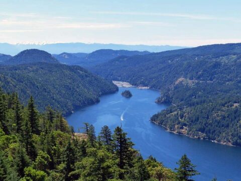
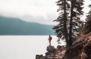
Looking for the perfect place to swim, paddle, or unwind under the sun? While Vancouver Island is famous for its rugged coastlines and stunning ocean beaches its freshwater lakes are equally magical! From paddleboarding on calm waters to waterskiing, fishing, or simply enjoying a lakeside picnic area, there’s a lake for every visitor!
Ready to find your ideal Vancouver Island vacation rental? With us, you’ll find a collection of beautiful, hand-picked vacation homes near all the best lakes! Whether you’re planning a relaxing getaway or a high-adventure vacation, our British Columbia vacation rentals give you ideal access to Vancouver Island’s top bodies of water!
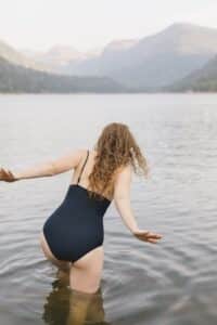
Warm water, easy entry points, docks and scenic sandy beaches make these lakes ideal for a refreshing summer (or cold weather) dip! With warm, clear waters and great jumping off points, these lakes take the top spots when it comes to freshwater swimming on Vancouver Island!
Spider Lake: This calm, shallow lake near Qualicum Beach is family-friendly with warm water, excellent visibility, and space for relaxed swimming.
Thetis Lake: Located just outside Victoria, this lake park features a designated beach area, shaded trails, and summer lifeguards—a classic local swim spot.
Shawnigan Lake: A warm, sunny lake with a true cottage country vibe. Public access points lead to picnic areas and gentle entry slopes.
Campbell Lake: Near Campbell River, this tranquil lake is known for warm water and relaxing summer swims in a peaceful natural setting.enturous and casual swimmers. Access to beach areas and trails makes it popular with families.
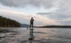
If you’re looking to explore Vancouver Island’s lakes by paddle, these top picks offer calm waters, scenic surroundings, and convenient boat launches. Plus the size of these lakes means you’ll have lots of exploring to do!
Cowichan Lake: One of the largest lakes on the island, this peaceful spot is ideal for long-distance kayaking, paddling, and canoeing with multiple launch points.
Kennedy Lake: Nestled near Tofino and Ucluelet, this expansive lake is perfect for paddlers! Try to get out on the water early in the day when it’s mirror-still.
Westwood Lake: Just outside Nanaimo, this lake features a 6-km loop trail and calm waters ideal for SUP and short paddles.
Cameron Lake: Easily accessed via Hwy 4, this lake is popular for canoeing and even a bit of windsurfing when the breeze picks up.
Nitinat Lake: This windswept lake near the west coast is a thrilling destination for experienced paddlers and windsurfers alike.
With healthy stocks of rainbow trout, smallmouth bass, and deep cool waters, these Vancouver Island lakes are favourites among local anglers.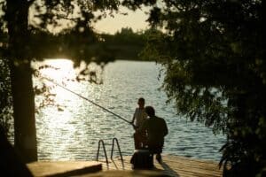
Sproat Lake: Located in Port Alberni, this deep, clear lake is renowned for trout fishing, shore casting, and trolling.
Spider Lake: Known as a smallmouth bass hotspot, it’s also a great spot for calm paddles and fishing from your kayak.
Comox Lake: A large lake with deep pockets of trout-rich waters. Excellent for anglers who want to fish by boat or from the shoreline.
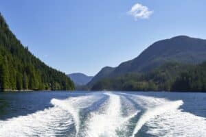
Ready to throttle up? These lakes offer excellent conditions for boating, waterskiing, tubing, and other water sports!
Cowichan Lake: With its sprawling shoreline, warm water, and numerous boat launches, it’s the ultimate boating destination.
Sproat Lake: Not just for anglers, this lake is known for smooth waters perfect for waterskiing and tubing.
Kennedy Lake: As the largest freshwater lake on the island, it has room for boats of all sizes and supports a wide variety of water sports.
Shawnigan Lake: With private docks and public day-use areas, this busy lake is a favourite for motorboats and tubing in the summer months.
Some lakes aren’t just for
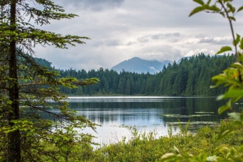
swimming—they’re a destination for a hike, a viewpoint, or even a peaceful forest picnic. These lakes combine hiking trails, picnic tables, and backcountry charm.
Buttle Lake: Set within Strathcona Provincial Park, this backcountry lake is surrounded by rugged trails and alpine beauty. A top pick for hikers and campers.
Westwood Lake: Just minutes from Nanaimo, the trail circling this lake is perfect for walking, jogging, or cycling with lakeside views the whole way.
Thetis Lake: Besides great swimming, it features multiple interconnected hiking trails ideal for shaded summer walks.
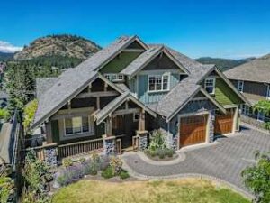
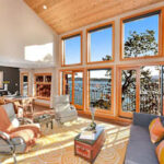
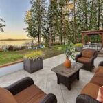
Looking for the perfect home base near Vancouver Island’s lakes? EMR Vacation Rentals offers a curated selection of Vancouver Island vacation homes, each designed to offer comfort, convenience, and a true west coast experience! Whether you’re visiting for a fun getaway or a multi-week retreat, our homes give you easy access to lake adventures across the region.


Cowichan Valley: Access top spots like Cowichan Lake and Shawnigan Lake, ideal for boating, paddling, and family getaways.
Nanaimo: Explore lakes like Westwood, Long Lake, and the surrounding Nanaimo Lakes for swimming, hiking, and summer recreation.
Greater Victoria & Saanich Peninsula: Perfect for accessing Thetis Lake, Elk/Beaver Lake, and other family-friendly lake parks.
Comox Valley: Stay near Comox Lake and take advantage of top-tier fishing, paddling, and trail access.
Parksville & Qualicum Beach: Ideal for visitors heading to Spider Lake, Horne Lake, and Cameron Lake.
Pacific Rim Region: Enjoy lakes like Kennedy Lake and Nahmint Lake while staying near Tofino, Ucluelet, and the heart of the west coast.
Many of our homes feature full kitchens, private patios, hot tubs, and extra space for gear like kayaks, paddleboards, or bikes. Whether you’re looking for a romantic retreat or a multi-family gathering, EMR has a property to match your style!
Book with confidence and get local expertise, guest support, and vacation rentals that feel like home!